
GIS as Appropriate Technology: Why It Deserves a Place at the Curriculum Table
How about we focus on application rather than mechanics?

To many, the acronym still sounds technical. Specialist. Perhaps even a little intimidating, and understandably so! Read the GIS Disconnect series by Rob Chambers and you will appreciate that GIS, as a powerful tool in a vast array of real-life decision making, is largely invisible from the Geography curriculum being taught in many schools.
I would like to argue that perhaps, in many cases, we don’t need to be explicit in teaching the scary technical/procedural knowledge of particular GIS packages, just practice the habit of recognising when it is being used in our every day lives.
Perhaps the problem is not GIS itself. Perhaps it is how we think about it.
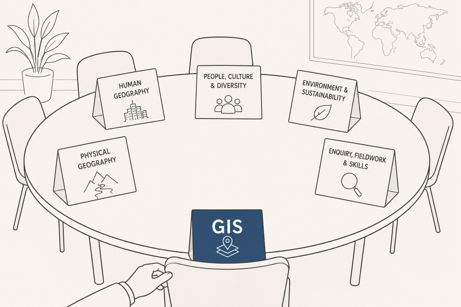
GIS as Appropriate Technology
In Geography, we regularly teach the concept of Appropriate Technology.
We discuss examples such as biogas tanks, hippo rollers and fog nets. Rarely do we focus on the science and engineering behind these technologies. Instead, we ask:
What problem does this solve?
Why is it appropriate in this context?
What are its strengths and limitations?
The focus is on application rather than mechanics.
Could GIS be viewed in the same way? Is this how we should be planning to implement it into curriculum? If we need to use the term, do we look to embed ‘GIS case studies?’
Most pupils do not need to understand spatial databases, georeferencing or complex analytical tools. What they do need to understand is how GIS can help us investigate places, identify patterns and make better decisions.
In that sense, GIS is not a topic to be learned for its own sake. It is a tool that enables geographical thinking.
The LifeStraw Analogy
One of my favourite examples of Appropriate Technology is the LifeStraw.
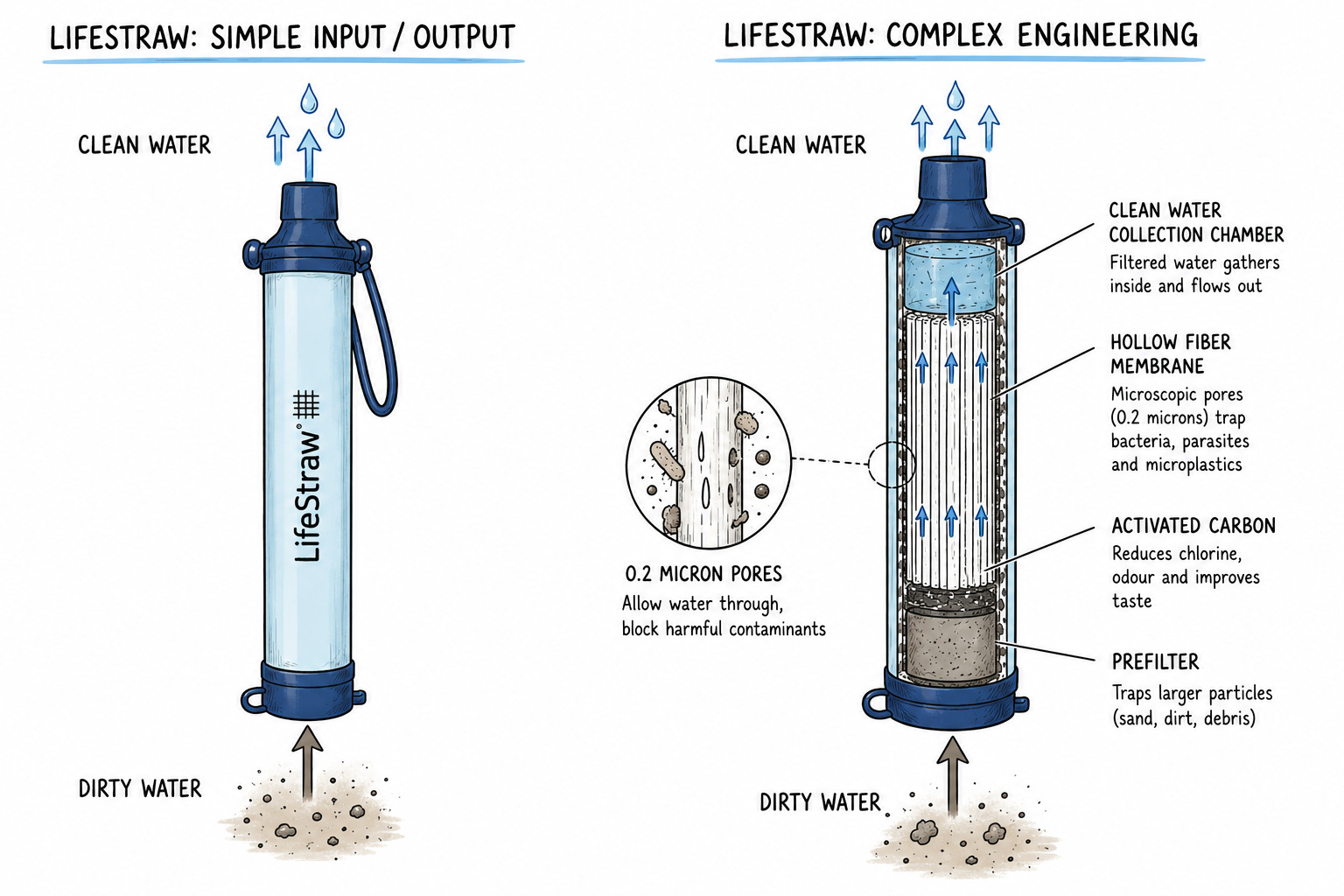
A person using a LifeStraw does not need to understand membrane filtration, pore sizes or the science behind water purification. They just know that unsafe water goes in and have reassurance that safe water comes out.
The technology works because it solves a problem.
GIS can be viewed in a similar way.
Most users do not need to understand every technical process happening behind the screen. What matters is understanding what the technology allows us to discover.
Data goes in. Better decisions come out.
Of course, some pupils may go on to study GIS in greater depth, just as some may become engineers or scientists. However, that should not prevent all learners from experiencing the benefits of the technology.
Why GIS Needs a Place at the Curriculum Table
For me, the strongest argument for GIS is not that it is a valuable digital skill, although it certainly is.
The stronger argument is that GIS reflects how Geography is practised in the modern world.
Governments use GIS to plan infrastructure. Environmental organisations use GIS to monitor habitats. Emergency planners use GIS to assess risk. Businesses use GIS to understand customers and locations. Scientists use GIS to investigate patterns and relationships. It also saves lives (how cool is What3Words by the way!?)

If geographical enquiry is about asking questions, gathering evidence and making informed decisions, then GIS has become one of the most powerful tools available to support that process.
We should not teach GIS because pupils might become GIS specialists.
We should teach GIS because it helps pupils think geographically.
As curriculum discussions continue, I hope GIS is not viewed as an optional extra or an advanced technical skill reserved for a minority. Instead, I hope it is recognised for what it really is: a modern tool that helps young people understand the world around them.
Perhaps GIS is today’s version of Appropriate Technology.
The challenge is not ensuring every pupil understands exactly how it works.
The challenge is ensuring every pupil knows when to reach for GIS, and what new understanding it can unlock.